搜索结果: 1-15 共查到“理学 disaster”相关记录37条 . 查询时间(0.125 秒)

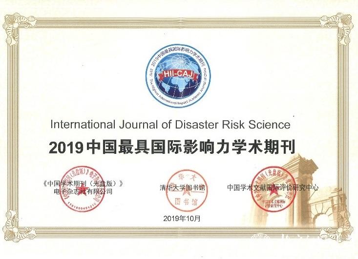
北京师范大学地理科学学部[荣誉]International Journal of Disaster Risk Science 《国际灾害风险科学学报》再次荣获“中国最具国际影响力学术期刊”称号(图)
国际灾害风险科学学报;中国;最具国际影响力;学术期刊
2021/11/11
近日,中国学术文献国际评价研究中心和清华大学图书馆研制、中国知网出版的《中国学术期刊国际引证年报》(2019版)正式发布,由北京师范大学第一主办,地理科学学部减灾与应急管理研究院承办的英文学术期刊International Journal of Disaster Risk Science再次入选“中国最具国际影响力学术期刊”(Top 5%)榜单。
郑州大学2019年攻读硕士学位研究生自命题有机化学考试大纲REATING SUSTAINABLE CITIES THROUGH DISASTER RESILIENCE IN TURKEY
郑州大学 硕士学位 研究生 自命题 有机化学 考试大纲
2019/4/19
郑州大学2019年攻读硕士学位研究生自命题有机化学考试大纲。
LANDSLIDE HAZARD ZONATION IN AND AROUND KEDARNATH REGION AND ITS VALIDATION BASED ON REAL TIME KEDARNATH DISASTER USING GEOSPATIAL TECHNIQUES
Landslide Hazard Zonation GIS Orthorectification Drainage Density Geomorphology
2019/2/28
Landslides are one of the frequently happening disasters in this hilly state of Uttarakhand which accounts to the loss of lives and property every year especially during the rainy season which lead to...
MEASURING URBAN RESILIENCE USING CLIMATE DISASTER RESILIENCE INDEX (CDRI)
Climate Disaster Resilience Index (CDRI) Climate Resilience Disaster Resilience Resilient City
2018/11/9
Measuring urban resilience is one of the important processes toward understanding the current and potential future risk of cities to guide the development of suitable policies and strategies related t...

北京师范大学主办的英文学术期刊International Journal of Disaster Risk Science影响因子创新高(图)
北京师范大学 英文 学术期刊 影响因子 创新高
2018/8/3
2018年6月26日,科睿唯安(原汤森路透知识产权与科技事业部)发布了2017年度最新《期刊引证报告》(Journal Citation Reports, JCR)。报告显示International Journal of Disaster Risk Science《国际灾害风险科学学报》2017影响因子达到2.225,在地球科学(GeoScience)、气象&大气科学(Meteorology &...
THE DETERMINATION METHOD OF EXTREME EARTHQUAKE DISASTER AREA BASED ON THE DUST DETECTION RESULT FROM GF-4 DATA
Earthquake Extreme Disaster Area Dust GF-4 Remote Sensing
2018/5/11
The remote sensing has played an important role in many earthquake emergencies by rapidly providing the building damage, road damage, landslide and other disaster information. The earthquake in the mo...
HAZARD ASSESSMENT OF LANDSLIDE DISASTER IN FUJIAN PROVINCE BASED ON FUZZY MATHEMATICS
Landslide Hazard Assessment Fuzzy Mathematics
2018/5/15
Landslide disasters are the most frequent geological disasters in Fujian Province. They are also the type of geological disasters that cause the most serious economic and population losses each year. ...
POST-DISASTER DAMAGE ASSESSMENT THROUGH COHERENT CHANGE DETECTION ON SAR IMAGERY
Coherent Change Detection, Synthetic Aperture Radar, Automatic post-disaster damage assessment, Earthquake
2018/5/14
Damage assessment is a fundamental step to support emergency response and recovery activities in a post-earthquake scenario. In recent years, UAVs and satellite optical imagery was applied to assess m...

Designing better warning systems for better disaster response(图)
Designing better warning systems better disaster response
2017/11/23
When a severe storm approaches, how a person responds can be a matter of life and death. Human response in the face of disaster greatly depends on how weather experts communicate the risks.NSF-funded ...
2017数据挖掘统计和数学工具专题会议(Special Session on Big Data and Disaster Management)
2017 数据挖掘统计和数学工具 专题会议
2017/9/21
Disasters are events that require multiple-agency responses, and resources beyond the capability of a community. Natural disasters put tremendous threats to the lives of people, in addition to economi...

Expanding Tropical Forest Spells Disaster for Conservation(图)
expanding tropical forest disaster conservation
2017/9/19
A North Carolina State University study shows that fire suppression efforts in Brazilian savannas turn many of those areas into forest lands, with negative consequences for the plants and animals that...
Ethics in disaster management
Geoethics Earthquake disasters Debris Flows Landslides Geohazards
2015/8/26
In any profession, a basic set of moral values needs to be followed to comply with what we call ethics. Geoscientists have significant roles to play, more particularly in the field of geohazards, to a...
DESIGN AND IMPLEMENTATION OF A WEB-BASED GIS (IN RESPONSE PHASE) FOR EARTHQUAKE DISASTER MANAGEMENT IN TEHRAN CITY
Earthquakes Disaster Management GIS Web based
2015/7/29
Natural hazards (i.e. earthquakes, floods) become disaster when they strike the man-made environment. To effectively reduce the
impact of every disaster, governments prepare a complete strategy, cal...
OCEAN POLICY:Post-Tsunami Field Surveys are Essential for Mitigating the Next Tsunami Disaster
Post-Tsunami Field Surveys Mitigating Next Tsunami Disaster
2015/7/9
Post-tsunami field investigations are an essential component for improving our understanding of tsunamis and in developing the tools and programs necessary to mitigate their effects. A destructive tsu...
CITIZEN SCIENCE FOR EARTH OBSERVATION: APPLICATIONS IN ENVIRONMENTAL MONITORING AND DISASTER RESPONSE
citizen science Earth observation
2015/5/7
Citizen science is a promising way to increase temporal and spatial coverages of in-situ data, and to aid in data processing and analysis. In this paper, we present how citizen science can be used to...

