搜索结果: 1-15 共查到“make rivers”相关记录116条 . 查询时间(0.059 秒)
Uncovering process domains in large rivers: Patterns and potential drivers of benthic substrate heterogeneity in two North American riverscapes
rivers North American benthic
2021/7/23
Identifying and understanding functional process domains (sensu Montgomery, 1999) in rivers is paramount for linking the physical habitat template to ecosystem structure and function.
Urban rivers are hotspots of riverine greenhouse gas (N2O, CH4, CO2) emissions in the mixed-landscape chaohu lake basin
Urban rivers greenhouse gas GHG Global warming
2021/7/27
Growing evidence shows that riverine networks surrounding urban landscapes may be hotspots of riverine greenhouse gas (GHG) emissions.

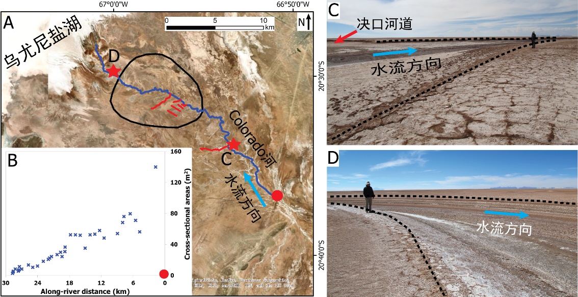
中国地质大学科学技术发展院李嘉光* 等,资源学院. Journal of Hydrology(2020), Digital Elevation Models for topographic characterisation and flood flow modelling along low-gradient, terminal dryland rivers: A comparison of spaceborne datasets for the Río Colorado, Bolivia(图)
精确表征;极低;缓河流;末端;地形;模拟河道;洪水;漫溢
2021/10/15
近日,国际知名期刊Journal of Hydrology在线刊发了中国地质大学资源学院李嘉光副教授团队在陆相湖盆边缘河流末端沉积体系研究的最新成果——Digital Elevation Models for topographic characterisation and flood flow modelling along low-gradient, terminal dryland rive...

Sea level rise could make rivers more likely to jump course(图)
Sea level rise make rivers likely jump course
2020/8/21
Sea level rise is poised to shift the way rivers naturally chart their paths to the shoreline. The nature of that change will depend on both the rate of rise and the sediment load carried by the river...

Freshwater runoff from rivers brings more carbon, nutrients to Arctic Ocean(图)
Freshwater runoff rivers carbon nutrients Arctic Ocean
2020/4/17
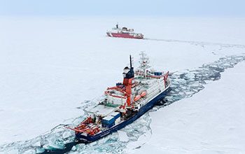
A new study by National Science Foundation-funded researchers at the Woods Hole Oceanographic Institution and their colleagues found that freshwater runoff from rivers and continental s...

南京水利科学研究院成功申办2021年国际航运协会 第10届内河航运国际学术会议(Smart Rivers 2021)(图)
南京水利科学研究院 2021年 国际航运协会 第10届 内河航运国际学术会议
2019/10/29
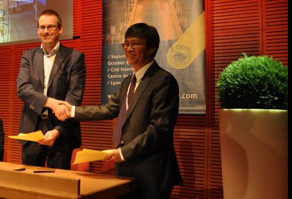
2019年10月3日,在法国里昂举办的国际航运协会(PIANC)第9届内河航运国际学术会议(Smart Rivers 2019)的闭幕式上,李云副院长应邀作大会报告,详细展示了我国在内河航运领域取得的巨大成就、京杭大运河过去、现在和未来、长江黄金水道工程、长江经济带战略以及南京和我院作为申办Smart Rivers 2021举办地与单位的优势。我院申办得到了国际航运协会的支持,国际航运协会秘书长G...

南京水利科学研究院成功申办2021年国际航运协会第10届内河航运国际学术会议(Smart Rivers 2021)(图)
南京水利科学研究院 2021年 国际航运协会 第10届 内河航运国际学术会议
2019/11/5
2019年10月3日,在法国里昂举办的国际航运协会(PIANC)第9届内河航运国际学术会议(Smart Rivers 2019)的闭幕式上,李云副院长应邀作大会报告,详细展示了我国在内河航运领域取得的巨大成就、京杭大运河过去、现在和未来、长江黄金水道工程、长江经济带战略以及南京和我院作为申办Smart Rivers 2021举办地与单位的优势。
张朋、梅廉夫*等 资源学院/构造与油气资源教育部重点实验室 Earth-Science Reviews(2019), Palaeodrainage evolution of the large rivers of East Asia, and Himalayan-Tibet tectonics
河流体系;区域构造;盆地发育;时效快;精度高;易追踪
2021/10/20
近日,地球科学国际权威期刊《Earth-Science Reviews》刊发中国地质大学资源学院和构造与油气资源教育部重点实验室梅廉夫教授团队,联合英国兰卡斯特大学Yani Najman教授等的研究成果。论文第一单位为构造与油气资源教育部重点实验室,第一作者为博士研究生张朋,梅廉夫教授与Yani Najman教授为共同通讯作者。

World Water Day: Citizen scientists provide valuable information on intermittent rivers(图)
World Water Day Citizen scientists valuable information intermittent rivers
2019/11/22
On World Water Day and throughout the year, citizen scientists are providing valuable data on intermittently dry rivers in the Southwest United States.Trained citizen scientists are mapping three such...
ACQUISION OF GEOMETRICAL DATA OF SMALL RIVERS WITH AN UNMANNED WATER VEHICLE
Unmanned Water Vehicle Multi-sensor Platform Mobile Mapping Lidar Echo Sounder Flash Flood
2018/6/5
Rivers with small- and medium-scaled catchments have been increasingly affected by extreme events, i.e. flash floods, in the last years. New methods to describe and predict these events are developed ...
Study:Mountaintop Coal Mining Causes Appalachian Rivers to Run ‘Consistently Saltier’
Mountaintop Coal Mining Appalachian Rivers Consistently Saltier
2017/7/25
Mountaintop-removal coal mining causes many streams and rivers in Appalachia to run consistently saltier for up to 80 percent of the year, a new study by researchers at the University of Wyoming and D...
OPTIMAL BAND RATIO ANALYSIS OF WORLDVIEW-3 IMAGERY FOR BATHYMETRY OF SHALLOW RIVERS (CASE STUDY:SARCA RIVER,ITALY)
Bathymetry River Optimal Band Ratio Analysis WorldView-3 GeoEye Spectral Bands
2016/11/30
The Optimal Band Ratio Analysis (OBRA) could be considered as an efficient technique for bathymetry from optical imagery due to its robustness on substrate variability. This point receives more attent...
REMOTE SENSING APPLICATION OF THE GEOPHYSICAL CHANGES IN THE COASTLINES AND RIVERS OF ZAMBALES,PHILIPPINES
Remote Sensing Accretion Erosion Geophysical changes Lahar
2016/11/30
Geophysical changes in river outlet, river upstream and coastlines near the rivers of Bucao and Santo Tomas in Zambales, Philippines were analyzed using the Google Earth’s historical satellite imageri...
MONITORING OF THE RIVERBEDS OF RIVERS DNIESTER AND TISZA OF THE CARPATHIAN REGION
Channel processes Monitoring Flooding Displacement of Channels Space images Topographic maps
2016/11/23
The paper analyses the causes of riverbed shifts of the rivers Dniester and Tisza of the Carpathian region. Among these reasons are mostly climate, physical and geographical, and anthropogenic factors...
APPLICATION FOR 3D SCENE UNDERSTANDING IN DETECTING DISCHARGE OF DOMESTICWASTE ALONG COMPLEX URBAN RIVERS
Scene Understanding Image Classification Co-Registration Urban Rivers Complex Terrain
2016/7/28
In our study we use 3D scene understanding to detect the discharge of domestic solid waste along an urban river. Solid waste found along the Ciliwung River in the neighbourhoods of Bukit Duri and Kamp...

