搜索结果: 1-15 共查到“摄影测量与遥感技术 Satellite”相关记录484条 . 查询时间(0.156 秒)

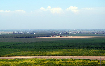
Researchers use satellite imaging to map groundwater use in California's Central Valley(图)
satellite imaging map groundwater California Central Valley
2020/10/16
Researchers at the University of California, San Diego report a new way to improve groundwater monitoring by using a remote sensing technology, known as InSAR (interferometric synthetic aper...
THE APPLICATION OF CHINESE HIGH-SPATIAL-RESOLUTION REMOTE SENSING SATELLITE IMAGE IN LAND LAW ENFORCEMENT INFORMATION EXTRACTION
land use high resolution batch process geoprocessing model information extraction mapping
2018/5/15
Chinese high -resolution (HR) remote sensing satellites have made huge leap in the past decade. Commercial satellite datasets, such as GF-1, GF-2 and ZY-3 images, the panchromatic images (PAN) resolut...
POSSIBILITY OF CLOUDLESS OPTICAL REMOTE SENSING IMAGES ACQUISITION STUDY BY USING METEOROLOGICAL SATELLITE OBSERVATIONS
Cloud total amount Cloudless image acquisition Fengyun(FY) satellite Ziyuan-3 (ZY-3) satellite
2018/5/16
Optical remote sensing images have been widely used in feature interpretation and geo-information extraction. All the fundamental applications of optical remote sensing, are greatly influenced by clou...
RETRIEVAL OF AEROSOL MICROPHYSICAL PROPERTIES BASED ON THE OPTIMAL ESTIMATION METHOD: INFORMATION CONTENT ANALYSIS FOR SATELLITE POLARIMETRIC REMOTE SENSING MEASUREMENTS
Polarimetric Remote Sensing Information Content Analysis Aerosol Microphysical Properties Optimal Estimation Multispectral Reconstruction
2018/5/14
This paper evaluates the information content for the retrieval of key aerosol microphysical and surface properties for multispectral single-viewing satellite polarimetric measurements cantered at 410,...
ANALYSIS AND APPLICATION OF LINEAMENTS EXTRACTION USING GF-1 SATELLITE IMAGES IN LOESS COVERED
Geological lineaments Remote Sensing GF-1 satellite images Hough Transform Edge detection
2018/5/14
Faults, folds and other tectonics regions belong to the weak areas of geology, will form linear geomorphology as a result of erosion, which appears as lineaments on the earth surface. Lineaments contr...
AN INSTANTANEOUS POINT SOURCE DETECTION AND EXTRACTION SYSTEM FOR GEO REMOTE SENSING SATELLITE
Instantaneous Point Source FPGA Remote Sensing Image Reconfigurable
2018/5/14
To accomplish the task of detecting the instantaneous point source, an on-board information real-time processing system is designed which can process the point-source detection with reconfigurable fun...
FULL-PHYSICS INVERSE LEARNING MACHINE FOR SATELLITE REMOTE SENSING OF OZONE PROFILE SHAPES AND TROPOSPHERIC COLUMNS
Atmospheric composition measurements Satellite remote sensing Machine learning Ozone UV spectroscopy
2018/5/16
Characterizing vertical distributions of ozone from nadir-viewing satellite measurements is known to be challenging, particularly the ozone information in the troposphere. A novel retrieval algorithm ...
MODELING AND SIMULATION OF HIGH RESOLUTION OPTICAL REMOTE SENSING SATELLITE GEOMETRIC CHAIN
High Resolution Geometric Chain Modeling Simulation Geolocation Accuracy
2018/5/16
The high resolution satellite with the longer focal length and the larger aperture has been widely used in georeferencing of the observed scene in recent years. The consistent end to end model of high...
SEA ICE DRIFT MONITORING IN THE BOHAI SEA BASED ON GF4 SATELLITE
GF4 image Sea ice Sift MCC Monitor
2018/5/17
The Bohai Sea is the inland sea with the highest latitude in China. In winter, the phenomenon of freezing occurs in the Bohai Sea due to frequent cold wave influx. According to historical records, the...
PROBLEMS AND LIMITATIONS OF SATELLITE IMAGE ORIENTATION FOR DETERMINATION OF HEIGHT MODELS
ZY3 WorldView-2 Pleiades Cartosat-1 systematic errors
2017/7/12
The usual satellite image orientation is based on bias corrected rational polynomial coefficients (RPC). The RPC are describing the direct sensor orientation of the satellite images. The locations of ...
POINTING ANGLE CALIBRATION OF ZY3-02 SATELLITE LASER ALTIMETER USING TERRAIN MATCHING
ZY3-02 Satellite Laser Altimeter Geometric Calibration Terrain Matching GLAS
2017/7/12
After GLAS (Geo-science Laser Altimeter System) loaded on the ICESat (Ice Cloud and land Elevation Satellite), satellite laser altimeter attracts more and more attention. ZY3-02 equipped with the Chin...
AN ENHANCED ALGORITHM FOR AUTOMATIC RADIOMETRIC HARMONIZATION OF HIGH-RESOLUTION OPTICAL SATELLITE IMAGERY USING PSEUDOINVARIANT FEATURES AND LINEAR REGRESSION
Radiometric Harmonization Pseudo-Invariant Features Sentinel-2 Remote Sensing Copernicus GIO HRL Forest
2017/7/12
The growing number of available optical remote sensing data providing large spatial and temporal coverage enables the coherent and gapless observation of the earth’s surface on the scale of whole coun...
ROOF TYPE SELECTION BASED ON PATCH-BASED CLASSIFICATION USING DEEP LEARNING FOR HIGH RESOLUTION SATELLITE IMAGERY
Roof Reconstruction High Resolution Satellite Imagery Deep Learning Method Convolutional Neural Networks
2017/7/13
3D building reconstruction from remote sensing image data from satellites is still an active research topic and very valuable for 3D city modelling. The roof model is the most important component to r...
FOSS4G DATE ASSESSMENT ON THE ISPRS OPTICAL STEREO SATELLITE DATA: A BENCHMARK FOR DSM GENERATION
Cartosat-1 Worldview-1 DSM Matching Accuracy FOSS4G
2017/7/13
The ISPRS Working Group 4 Commission I on “Geometric and Radiometric Modelling of Optical Spaceborne Sensors”, provides a benchmark dataset with several stereo data sets from space borne stereo sensor...
The Geometric Calibration and Validation for The ZY3-02 Satellite Optical Image
the satellite ZY3-02 imaging geometric model geometric calibration interior orientation
2017/7/13
Chinese ZY3-02 satellite, which is the second of ZY3 series satellites, was launched in May 30th 2016 for complementing the mapping and earth observation. In order to eliminate various system errors o...

