搜索结果: 1-15 共查到“知识库 Mountain”相关记录333条 . 查询时间(0.093 秒)
Assessment of an improved individual tree detection method based on local-maximum algorithm from unmanned aerial vehicle RGB imagery in overlapping canopy mountain forests
CROWN DETECTION POINT CLOUDS UAV IMAGERY SEGMENTATION DELINEATION LIDAR INVENTORY HEIGHT FIELD
2023/12/15
Low consumer-grade cameras attached to small unmanned aerial vehicles (UAV) can easily acquire high spatial resolution images, leading to convenient forest monitoring at small-scales for forest manage...
Modeling Tree Growth Responses to Climate Change: A Case Study in Natural Deciduous Mountain Forests
biotic and abiotic factors climate change Hyrcanian Forest machine learning RCP scenarios
2023/11/22
Climate change has significant effects on forest ecosystems around the world. Since tree diameter increment determines forest volume increment and ultimately forest production, an accurate estimate of...
Age-independent diameter increment models for mixed mountain forests
Age-independent growth equations Algebraic difference approach Mixed effects models Uneven-aged forest Mixed species forests Growth index
2023/11/20
Mixed mountain forests with an uneven-aged structure are characterized by a high tree-growth?variability making traditional age-dependent?growth?models inapplicable. Estimating site productivity is ye...
Evaluation of sensory and safety quality characteristics of “high mountain tea”
Evaluation sensory safety quality characteristics high mountain tea
2024/7/30
High mountain tea (HT) is widely acknowledged as an essential resource of high quality tea due to its adaptation to superior ecological environments. In this study, the sensory (aroma and taste) and s...

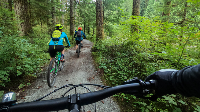
Cross country mountain biking is an Olympic sport. A mountain biking event typically lasts two hours and requires bravery, bike skill, and endurance to navigate the course.
AGB Estimation in a Tropical Mountain Forest (TMF) by Means of RGB and Multispectral Images Using an Unmanned Aerial Vehicle (UAV)
forest AGB UAV RGB data multispectral data
2024/2/4
The present investigation evaluates the accuracy of estimating above-ground biomass (AGB) by means of two different sensors installed onboard an unmanned aerial vehicle (UAV) platform (DJI Inspire I) ...
OPTIMIZED ORGANIZATION AND ADAPTIVE VISUALIZATION OF COMPLICATED MOUNTAIN DISASTER 3D SCENES FOR DIVERSE TERMINALS
Mountain Disaster 3D Scenes Adaptive Visualization
2018/11/9
Mountain disaster scenes usually contains various geographical entities, which are dynamic and complicated. Therefore, the construction of mountain disaster 3D scenes has great significance for disast...
TECHNICAL ASPECTS RELATED TO THE APPLICATION OF SFM PHOTOGRAMMETRY IN HIGH MOUNTAIN
Alpine Environment Glaciology Photogrammetry Structure-from-Motion UAV/UAS
2018/6/5
Structure-from-Motion (SfM) photogrammetry is a flexible and powerful tool to provide 3D point clouds describing the surface of objects. Due to the easy transportability and low-cost of necessary equi...
FLASH FLOOD MAPPING FOR MOUNTAIN STREAMS USING HIGH-RESOLUTION ALOS-2 DATA
ALOS-2 Capacity building Flood detection Valley floodplain
2018/4/18
This paper introduces a practical way to improve the risk management capacity and resilience of communities by utilizing a prompt flash flood map produced from very high spatial resolution ALOS-2 data...
FLASH FLOOD MAPPING FOR MOUNTAIN STREAMS USING HIGH-RESOLUTION ALOS-2 DATA
ALOS-2 Capacity building Flood detection Valley floodplain
2018/5/8
This paper introduces a practical way to improve the risk management capacity and resilience of communities by utilizing a prompt flash flood map produced from very high spatial resolution ALOS-2 data...
Assessing the amount of soil organic matter and soil properties in high mountain forests in Central Anatolia and the effects of climate and altitude
forest soil topographic conditions climate model semi-arid regions Turkey
2017/6/26
The objectives of this study were to determine the amounts of soil organic matter (SOM) stored within surface soils of high mountain forests and how the SOM amounts are affected by aridity and altitud...
LAND USE/LAND COVER CHANGES IN SEMI-ARID MOUNTAIN LANDSCAPE IN SOUTHERN INDIA: A GEOINFORMATICS BASED MARKOV CHAIN APPROACH
Land cover Markov Kallar NDVI Drought Geoinformatics
2017/7/12
Nowadays land use/ land cover in mountain landscape is in critical condition; it leads to high risky and uncertain environments. These areas are facing multiple stresses including degradation of land ...
DEFORESTATION ALONG THE MAYA MOUNTAIN MASSIF BELIZE-GUATEMALA BORDER
Deforestation Transboundry Maya Mountain Massif Protected Areas Biodiversity Belize
2016/11/30
In recent years trans-boundary incursions from Petén, Guatemala into Belize’s Maya Mountain Massif (MMM) have increased. The incursions are rapidly degrading cultural and natural resources in Belize’s...
IMPROVED CORRECTION METHOD FOR WATER-REFRACTED TERRESTRIAL LASER SCANNING DATA ACQUIRED IN THE MOUNTAIN CHANNEL
TLS water refraction acquisition correction underwater point cloud
2016/11/30
Detailed information of underwater topography is required for better understanding and prediction of water and sediment transport in a mountain channel. Recent research showed promising utility of gre...
MONITORING OF FLUVIAL TRANSPORT IN THE MOUNTAIN RIVER BED USING TERRESTRIAL LASER SCANNING
Terrestrial Laser Scanning Monitoring Fluvial Geomorphology Mountain River Sudetes
2016/11/23
The fluvial transport is the surface process that has a strong impact on the topography changes, especially in mountain areas. Traditional hydrological measurements usually give a good understanding o...

