
搜索结果: 1-15 共查到“地图学 GIS”相关记录31条 . 查询时间(0.153 秒)
虚实融合技术是视频增强三维虚拟地理场景的关键环节之一,对提高真实沉浸式视觉体验具有重要作用。现有基于视频投影的虚实融合方法,在三维场景动态更新时,通常需要对用户视角下新场景内所有渲染对象进行遍历,来筛选出摄像头范围内需融合的对象,导致融合过程耗时长、效率不高。本文提出一种顾及拓扑关系的多路视频与三维GIS场景融合的对象快速确定方法。首先对三维场景视锥体内视频对象集渲染对象动态建立拓扑网络模型;然后...
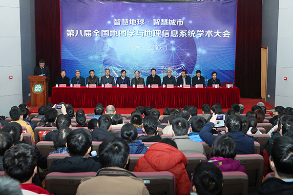
2016年11月25至28日,第八届全国地图学与GIS学术大会在南京师范大学举行。本届大会由中国测绘地理信息学会地图学与GIS专业委员会、中国地理学会地图学与GIS专委会、中国地理信息产业协会地图工作委员会、中国地质学会地质制图与地理信息专委会、中国自然资源学会资源制图专委会五家联合主办,由南京师范大学及省遥感与GIS学会、省测绘地理信息学会、省地理信息资源开发与利用协同创新中心、虚拟地理环境教育...
南京师范大学地理科学学院地图学(实验)英文课件Experiment2 Map projection function in GIS software
南京师范大学地理科学学院 地图学 实验 英文 课件 Experiment2 Map projection function in GIS software
2015/7/15
南京师范大学地理科学学院地图学(实验)英文课件Experiment2 Map projection function in GIS software。
GIS based mapping and environmental impact of Wetlands changes in a Riverine district of Bangladesh
Bangladesh Wetlands Changes Management Environmen
2014/11/26
This research is concerned with the GIS based mapping and change of areal extent of
wetlands within two different periods and to identify the causes of change and impact
assessment of wetland chan...
Landuse / Landcover change study of Jharkhali Island Sundarbans, West Bengal using Remote Sensing and GIS
Sundarban Landuse change Population pressure Deforestation
2014/11/26
Jharkhali, an island in the Sundarbans, is situated between two mighty rivers, Matla (on the
west) and Bidya (on the east) covering an area of about 161 sq.km (2009). The landuse /
landcover maps ...
Prioritisation of miniwatersheds based on Morphometric analysis using GIS
Morphometric analysis ArcGIS Watershed delineation Watershed atlas
2014/11/26
In the present study, the eighteen miniwatersheds of Kadam watershed of Middle Godavari
sub basin (G-5) have been prioritized using GIS based on morphometric analysis. The highest
Bifurcation rati...
Morphometric analysis of Maun watershed in Tehri-Garhwal district of Uttarakhand using GIS
Drainage network GIS Landuse Morphometric analysis
2014/11/26
Proper planning and management of available natural resources is necessary for progress and
economic development in agriculture which are main stay of people leaving in the hilly
region. The morph...
Quantitative Morphometric analysis of Kosasthalaiyar sub basin (Chennai basin) using remote sensing (SRTM) data and GIS techniques
SRTM data GIS techniques Morphometric analysis
2014/11/19
The growing competition demand for water from industrial, domestic, and environmental
sectors, along with increasing intensity of quality and quantity challenges as a result of rapid
urbanization,...
Spatio-temporal analysis of land use - land cover changes in Delhi using remote sensing and GIS techniques
Land cover changes Remote sensing and GIS Maximum Likelihood
2014/11/19
Temporal land cover changes have a strong effect on the urban environment and its
surroundings. In the present study, Delhi metropolitan area has been considered for the
detection of land cover ch...
Mapping and monitoring of land use and land cover changes using Remote Sensing and GIS techniques
Coastal zone Land uses land cover change detection
2014/11/19
With passage of time, Land use and Land cover (LULC) of coastal area undergoes significant
change due to varying natural and anthropogenic causes. So it is essential to monitor the
changes in land...
Application of Remote Sensing and GIS in studying changing river course in Bankura District, West Bengal
Remote Sensing Geographical Information System Sinuosity Index
2014/11/19
Remote Sensing and Geographical Information System has emerged as the most important tool
of a geographer to handle spatial data. This technique is now widely used around the world to
analyse phys...
Rapid urban growth in the city of Duhok, Iraqi Kurdistan Region: An integrated approach of GIS, Remote Sensing and Shannon Entropy application
GIS remote sensing Landsat TM Urban sprawl Shannon entropy
2014/11/17
Duhok, a mountainous city in Kurdistan Region of Iraq, has witnessed rapid urban growth over
the past decade due to population growth and economic improvements. These factors have
placed a great p...
Assessment and Prediction of Impact and Effectiveness of Watershed Management Practices on Land Use Land Cover in Seoni Watershed, Madhya Pradesh using Remote Sensing and GIS
Impact and effectiveness Broad band vegetation Indices
2014/11/17
This research work has been carried out to assess the impact and effectiveness of watershed
management practices on land use land cover of the Seoni watershed area with the help of
satellite remot...
Detection of land use and land cover change with Remote Sensing and GIS: A case study of Punjab Siwaliks
Land use land cover change Remote sensing
2014/11/17
The term land use relates to the human activities or economic functions associated with a
specific piece of land while land cover is the physical material at the surface of the earth. Land
cover i...
Suitability analysis for tourist infrastructures utilizing multi-criteria GIS: A case study in Al-Hada city, Saudi Arabia
GIS multi criteria analysis site suitability tourism land use Saudi Arabia
2014/11/17
Nowadays, GIS is widely recognized as a valuable decision support system that enables the
determination of suitable spatial locations for a specific objective based on a group of criteria.
This pa...